Search Term Record
Metadata
Search Term |
Lump Gulch |
Number of Object records |
1 |
Number of Photo records |
29 |
Number of Archive records |
0 |
Number of Library records |
1 |
Related Records
-
Bucket at King Solomon Mine - Photograph
The bucket at King Solomon Mine between Clancy Creek and Lump Gulch. The King Solomon Mine is in Clancy, Montana. Historically the site has been associated with the Clancy-Lump Gulch Mining District which is now part of the Helena National Forest. The site was first discovered in 1889. The King Solomon Mine is a underground mining operation. Initial production took place in 1889 and overall output was considered to be small size. Mine operatio...
Record Type: Photo
-
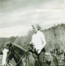
Charlotte Stubblefield - Photograph
Black and white photograph of Charlotte Stubblefield riding a horse on her ranch up Lump Gulch; she is the mother of Joan, Gerry, and Kay.
Record Type: Photo
-
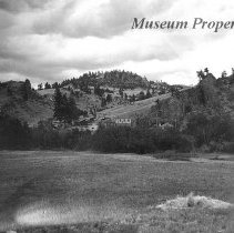
Clancy, Montana looking east up the gulch - Photograph
A black and white photograph from Clancy, Montana, looking east up the gulch where the Legal Tender Mine is located. The picture includes buildings that were part of the mine operations.
Record Type: Photo
-
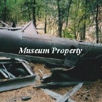
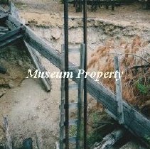
Head Frame and ladder from King Solomon Mine - Photograph
Head frame and ladder from the King Solomon Mine up Clancy Creek and Lump Gulch in Clancy Montana. The King Solomon Mine is in Clancy, Montana. Historically the site has been associated with the Clancy-Lump Gulch Mining District which is now part of the Helena National Forest. The site was first discovered in 1889. The King Solomon Mine is a underground mining operation. Initial production took place in 1889 and overall output was considered ...
Record Type: Photo
-
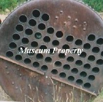
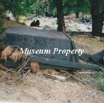
Horizontal Receiving Tank - Photograph
Horizontal receiving tank at King Solomon Mine between Clancy Creek and Lump Gulch in Clancy Montana. The King Solomon Mine is in Clancy, Montana. Historically the site has been associated with the Clancy-Lump Gulch Mining District which is now part of the Helena National Forest. The site was first discovered in 1889. The King Solomon Mine is a underground mining operation. Initial production took place in 1889 and overall output was consider...
Record Type: Photo
-
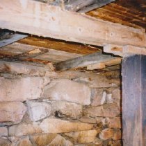
Interior of Mae Wing Vincent Barn - Photograph
Color photograph of the back inside wall against hillside of the Mae Wing Vincent barn in Lump Gulch; it is a small square log hand built barn c. 1920.
Record Type: Photo
-
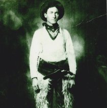
John D. McEachern Dressed In Cowboy Attire - Photograph
Black and white photograph of John Daniel McEachern (1884-1947) of Clancy, Montana.
Record Type: Photo
-
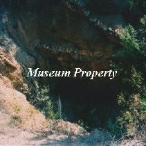
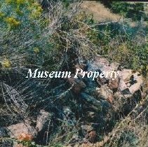
King Solomon Mine - Photograph
Bucket at the King Solomon Mine which is located in Clancy Montana. The King Solomon Mine is in Clancy, Montana. Historically the site has been associated with the Clancy-Lump Gulch Mining District which is now part of the Helena National Forest. The site was first discovered in 1889. The King Solomon Mine is a underground mining operation. Initial production took place in 1889 and overall output was considered to be small size. Mine operation...
Record Type: Photo
-
King Solomon Mine - Photograph
The King Solomon Mine is in Clancy, Montana. Historically the site has been associated with the Clancy-Lump Gulch Mining District which is now part of the Helena National Forest. The site was first discovered in 1889. The King Solomon Mine is a underground mining operation. Initial production took place in 1889 and overall output was considered to be small size. Mine operations consist of surface and underground workings. There is one known shaft...
Record Type: Photo
-
Ladder and head frame shaft - Photograph
Ladder and head frame shaft at the King Solomon Mine in Clancy Montana. The King Solomon Mine is in Clancy, Montana. Historically the site has been associated with the Clancy-Lump Gulch Mining District which is now part of the Helena National Forest. The site was first discovered in 1889. The King Solomon Mine is a underground mining operation. Initial production took place in 1889 and overall output was considered to be small size. Mine opera...
Record Type: Photo
-
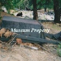
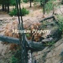
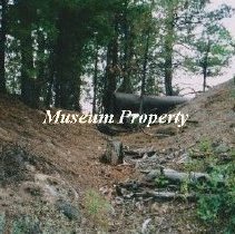
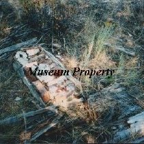
Little Nell Mine - Photograph
Tailings at the Little Nell Mine taken in 2007 which is located in Clancy Montana up Lump Gulch. The mine was 550 feet at one time in 1897.
Record Type: Photo

-
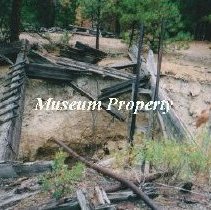
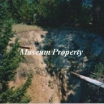
Little Nell Mine - Photograph
Little Nell Mine taken in 2007 which is located in Clancy Montana up Lump Gulch.This is the out building at Little Nell. The mine was 550 feet at one time in 1897.
Record Type: Photo
-
Little Nell Mine - Photograph
Little Nell Mine taken in 2007 which is located in Clancy Montana up Lump Gulch.The mine was 550 feet at one time in 1897.
Record Type: Photo
-
Little Nell Mine - Photograph
Little Nell Mine taken in 2007 which is located in Clancy Montana up Lump Gulch. The utility wire is on the left side of the road. The mine was 550 feet at one time in 1897.
Record Type: Photo
-
Little Nell Mine - Photograph
Little Nell Mine up Lump Gulch in Clancy Montana. The mine was 550 feet at one time in 1897.
Record Type: Photo
-
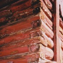
Mae Wing Vincent Barn - Photograph
Color photograph of Mae Wing Vincent barn in Lump Gulch; it is a small hand built square cut log barn c. 1920.
Record Type: Photo

-
Mae Wing Vincent Barn - Photograph
Color photograph of the square log construction of the Mae Wing Vincent barn in Lump Gulch; it is a small square log hand built c. 1920.
Record Type: Photo
-
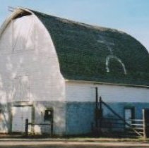
Marks Barn in Clancy - Photograph
Color photograph of Marks barn in the Lump Gulch area of Clancy; built 1923; there is an exact replica to 1/9 scale of this barn in the museum.
Record Type: Photo