Site Record
Metadata
Site Name |
Basin, Montana |
Site# |
3 |
Elevation in Feet |
5364 |
Latitude Degrees |
46 |
Longitude Degrees |
112 |
Maps |
https://www.google.com/maps/place/46%C2%B016'17.0%22N+112%C2%B015'49.0%22W/@46.271389,-112.263611,624m/data=!3m1!1e3!4m5!3m4!1s0x0:0x0!8m2!3d46.271389!4d-112.263611 |
Northing |
5124977 |
Easting |
402635 |
Zone |
12 |
East/West |
W |
Related Records
-
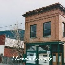
Basin Business Buildings - Photograph
Color photograph of two business buildings in Basin, Montana; the two story building was once used as the Masonic Hall.
Record Type: Photo
-
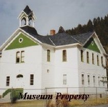
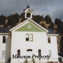
Basin Grade School - Photograph
Color photograph of Basin Elementary School in Basin, Montana. The Basin Grade School was constructed in 1895. The contractor used wood plank siding, created decorative woodwork in the halls and classrooms, and installed small circular windows. A wooden belfry was built for the school bell. The school currently houses grades pre-kindergarten to sixth grade; serves 15-20 students.
Record Type: Photo
-
Basin School - Photograph
Color photograph of Basin School. The Basin Grade School was constructed in 1895. The contractor used wood plank siding, created decorative woodwork in the halls and classrooms, and installed small circular windows. A wooden belfry was built for the school bell. The school currently houses grades pre-kindergarten to sixth grade; serves 15-20 students.
Record Type: Photo
-
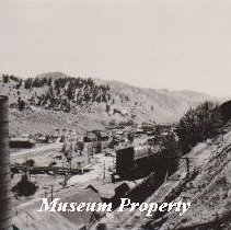
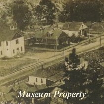
Basin School and Surrounding Residences - Photograph
Black and white aerial photograph of Basin School and other nearby buildings taken from the hill west of town.
Record Type: Photo
-
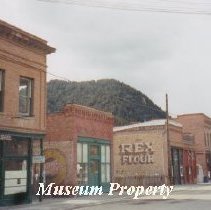
Basin Street Businesses of Basin, Montana - Photograph
Color photograph showing some of the businesses on Basin Street, Basin, Montana.
Record Type: Photo
-
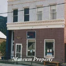
Business Building in Basin - Photograph
Color photograph of a business building in Basin. This building was used in 1903 for Driscol Grocery, then in 1905 by the Atwater Mining Company; at the time of this picture West Liberty Books, Etc. was located here.
Record Type: Photo
-
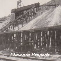
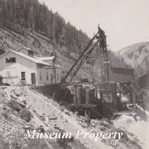
Hope Mine in Basin - Photograph
Black and white picture of Hope Mine and mill buildings; looking east, Katie Mine in background, with Great Northern Railroad in foreground.
Record Type: Photo

-
Katie & Hope Mines in Basin - Photograph
Black and white photograph of Hope Mine loading dock and Katie Mine headframe in Basin; railroad tracks in foreground.
Record Type: Photo
-
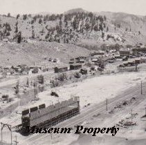
Katie Mine and Basin Townsite - Photograph
Black and white photograph of Basin townshite and Katie Mill ore loading dock; also note in the picture: bridge across Boulder River, Great Northern Railroad, and Joe Bowers cabin.
Record Type: Photo
-
Katie Mine in Basin - Photograph
Black and white photograph of the Hope Mine headframe and hoist house in Basin. Hope Mine is in the distance looking west.
Record Type: Photo
-
Katie Mine of Basin Townsite - Photograph
Black and white photograph of Basin townsite lookin east; Katie Mine headframe, mill stack and bridge across Boulder River can be seen.
Record Type: Photo